Offroading Nearby
One of over 34 Spot2Nite camping activities
Fuel your adventurous spirit at campgrounds and RV parks near offroading trails. Whether you're into ATVs, dirt bikes, or 4x4 vehicles, these destinations provide access to rugged terrains and thrilling rides, making them ideal for offroad enthusiasts.
RV parks and campgrounds with Offroading Nearby near Huntsville, Utah.
5.0
City of Rocks RV
23 RV Sites, 5 Tent Sites
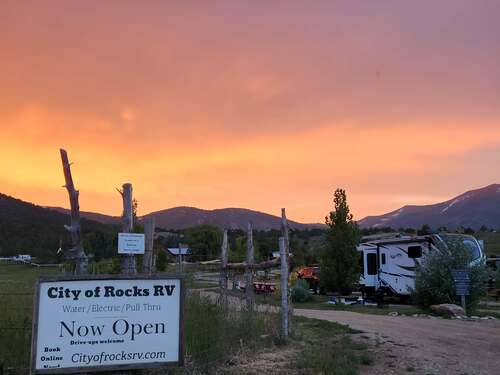
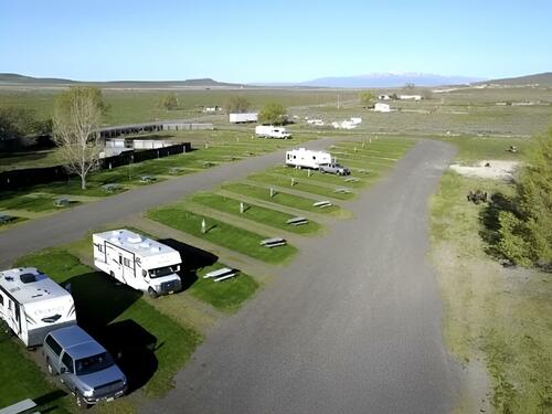
City of Rocks RV in Almo, Idaho, is the gateway campground at the entrance to the City of Rocks National Reserve in Cassia County — a partial-hookup (water and electric 20/30/50 amp) campground with big rig pull-through sites serving rock climbers, history enthusiasts, and high-desert nature explorers who make the pilgrimage to the City of Rocks' extraordinary collection of granite spires, domes, and pinnacles in the Albion Mountain range of southern Idaho. Almo's position at the base of the Silent City of Rocks gives City of Rocks RV the most convenient possible base for the reserve that outdoor recreation and history publications have consistently recognized as one of the most significant and most visually dramatic natural areas in the Pacific Northwest. Partial hookup sites with water and electric service at 20, 30, and 50 amps, big rig pull-through capacity, and Pioneer Bathrooms give guests the practical infrastructure for comfortable campground stays adjacent to one of the most unique geological landscapes in the American West. The campground's gateway position — literally at the entrance to the City of Rocks National Reserve — minimizes the drive between campsite and the reserve's trailheads, rock climbing routes, and historical sites. Pets are welcome. The City of Rocks National Reserve encompasses 14,407 acres of the Albion Mountains in Cassia County where 2.5-billion-year-old granite intrusions have eroded into the extraordinary collection of spires, domes, and balanced rocks that the California Trail's emigrant travelers named the "Silent City" in the 1840s — a landscape so otherworldly that the emigrants' diaries consistently described it in terms of architecture and urban analogy rather than conventional geological description. The reserve's 600 technical rock climbing routes, distributed across the granite formations from beginner slab climbs to expert crack and face routes, have made City of Rocks one of the premier rock climbing destinations in the western United States, with classic routes on formations like Elephant Rock, Morning Glory Spire, and The Parking Lot Wall drawing climbers specifically from across the Pacific Northwest and Intermountain West. The California Trail, one of the most heavily traveled overland emigrant routes of the 1840s-1860s, passed through the City of Rocks between 1843 and 1882 — and the granite formations of the Silent City preserves the original axle grease inscriptions that California-bound emigrants left on the smooth granite surfaces as informal guest registers documenting their passage westward. The National Park Service's interpretive program at the reserve interprets this trail heritage alongside the geological and biological character that make the City of Rocks a nationally significant landscape of multiple overlapping values. City of Rocks RV serves guests through the Cassia County outdoor recreation season from spring through fall, with the rock climbing season centered in the cooler months of May through June and September through October when the granite's surface temperature allows friction climbing that the July and August midday heat prevents. Twin Falls, 60 miles northwest, provides the full-service city's dining, lodging, and the Shoshone Falls — a Niagara-height waterfall on the Snake River sometimes called the Niagara of the West — that extends the day-trip range from the Almo base into the Snake River Plain's geological drama. Reserve sites ahead for the prime spring and fall rock climbing seasons, when the City of Rocks area's very limited commercial accommodation fills from the regional and national climbing community.
from $20/night
5.0
Aspen Grove Inn at Heise Bridge
30 RV Sites, 6 Cabins, 11 Tent Sites, 4 Cottages, 2 Yurts, 1 Onsite RV/Trailer, 1 House
Aspen Grove Inn at Heise Bridge in Rigby, Idaho, offers year-round accommodations in eastern Idaho's Snake River Plain — RV and camp sites, cabins, private cottages, yurts, glamper campers, and a lodge with bunkhouse giving guests a comprehensive range of lodging options in Jefferson County's agricultural and outdoor recreation landscape between Idaho Falls and the Teton Valley. The property's year-round operation and accommodation diversity serve the full spectrum of eastern Idaho visitors: fly fishing and float trip guests on the Henry's Fork and South Fork of the Snake River, Yellowstone National Park travelers using Idaho Falls as their western park approach, and the regional outdoor recreation community pursuing the Snake River Plain's volcanic geology and the surrounding public land network. RV sites with hookups, tent camping, cabins, cottages, yurts, glamper campers, and the lodge and bunkhouse give the property the most comprehensive accommodation range of any camping property in eastern Idaho — a flexibility that serves solo anglers, family groups, corporate retreat groups, and outdoor organizations whose equipment and accommodation needs span the full range that a property of this accommodation depth can address. The year-round operation maintains availability through the winter months when the surrounding Snake River Plain's fishing and wildlife activity continues in modified form from the summer peak. Pets are welcome. The Henry's Fork of the Snake River, flowing south from Henry's Lake through Island Park and the Mesa Falls corridor toward Ashton, is one of the most famous spring creek dry-fly fisheries in the world — the Railroad Ranch section through the Harriman State Park meadow, where rainbow trout of 18 to 24 inches rise in spring creek-style feeding lanes to mayfly and caddis hatches that the Henry's Fork's cold, clear spring flow sustains, is specifically cited in international fly fishing literature as a standard of difficult, technical, demanding trout fishing. The South Fork of the Snake River through the Swan Valley provides the float fishing complement — a large, productive freestone river where the rainbow and cutthroat trout populations support a guide industry of significant regional scale. Yellowstone National Park, approximately 90 miles north and east via the US Highway 20 and State Highway 47 Island Park corridor, gives Rigby the western approach to the park that avoids the congested South Entrance from Jackson Hole — a less-traveled approach through Island Park's volcanic caldera and the Ashton-Flagg Ranch Road into the park's Bechler and Falls River country in the park's southwestern quadrant. The Grand Teton National Park's western Snake River approach from Victor, Idaho, over the Teton Pass, provides the additional mountain scenery corridor accessible from the eastern Idaho base. Aspen Grove Inn at Heise Bridge operates year-round in eastern Idaho's continental climate, where the summer season from June through September provides the peak fly fishing, Yellowstone touring, and outdoor recreation activity and the winter months offer the specific cold-weather Idaho experience of the Snake River Plain landscape. The Ririe Reservoir, immediately west of Rigby, provides motorized water recreation, fishing, and the Tex Creek Wildlife Management Area's hunting access for the eastern Idaho visitor base. Reserve cabins, cottages, and lodge accommodations ahead for the peak summer fly fishing season when the Henry's Fork and South Fork guide bookings fill months in advance and overnight accommodation in Jefferson County fills from the regional fishing and Yellowstone travel market.
from $30/night
4.0
Big Rock Candy Mountain Resort
34 RV Sites
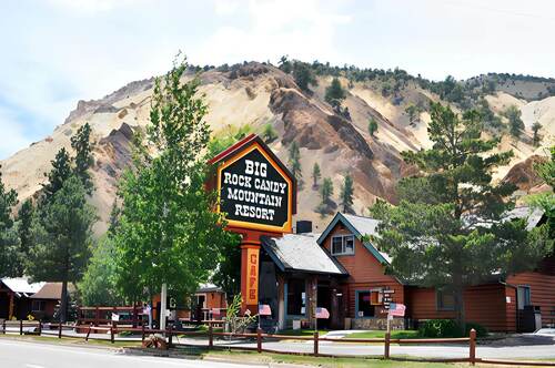
Big Rock Candy Mountain Resort in Sevier, Utah, offers 34 RV sites with full and partial hookups at the base of the actual Big Rock Candy Mountain, with 30 and 50-amp service and rigs accepted up to 80 feet. A zip line through the canyon, bike rentals, on-site dining, and Sevier River access make this a destination rather than a roadside stop on US-89. Thirty-four sites run from water-and-electric back-ins to full-hookup back-in and pull-through configurations carrying 30 and 50-amp, sized to 80 feet, with fire pits. A general store, propane fills, laundry, restrooms, showers, and a dump station handle the practical side. One important caveat: cell service at the resort is essentially non-existent, with coverage available four miles south and seven miles north. There are no phones in the cabins or inn suites, and no payphones — a landline in the convenience store is available during operating hours. The canyon setting drives the recreation. A zip line runs through the colorful canyon terrain, bike rentals open the riverside trail, and the Sevier River supports kayaking, canoeing, and fishing for brown and rainbow trout. Hiking trails climb into the canyon, a recreation center and planned activities fill the calendar, and an on-site dining room covers meals. Off-roading and boating are nearby. Pets are welcome. The mountain itself is the landmark — sulfur-yellow, iron-red, and manganese-white mineral deposits in the canyon walls that gave the classic American folk song its image of an effortless paradise. The resort sits on the US-89 scenic corridor between Richfield and Marysvale. Summer is the peak season for the zip line, river, and trail access; plan communications around the lack of cell coverage before you arrive.
from $42/night
4.67
Fremont River RV
24 RV Sites
On Highway 24 in Loa, Utah—in Wayne County on the Fremont River's upper valley where the Capitol Reef National Park's Waterpocket Fold—a 100-mile-long wrinkle in the earth's crust exposed by erosion into the canyon country's most continuous monocline—lies 15 miles east on the same highway, and where the Fishlake National Forest's 1.4-million acres of high-plateau fish-stocked lakes, aspen groves, and the Fish Lake highland plateau create the southern Utah outdoor recreation corridor that the Wayne County setting concentrates at the geographic center of a five-national-park road trip circuit—Fremont River RV Park provides eight pull-through sites accommodating up to 75 feet, ten back-in sites accommodating up to 60 feet, all with full hookups and 20, 30, and 50-amp service, six tent sites with power and water, a dump station, laundry, restrooms, showers, and fast WiFi in the Loa, Utah highway campground that walking-distance access to groceries, a diner, gas, propane, and auto repair makes the most practically positioned campground between Capitol Reef and the Fish Lake highland. The 75-foot pull-through accommodation, the walking-distance supply access, and the equidistant Capitol Reef and Fish Lake positioning define Fremont River RV's utility as a southern Utah canyon country base camp. Eight pull-through sites accommodating rigs up to 75 feet and ten back-in sites accommodating up to 60 feet—all with full electric, water, and sewer hookups at 20, 30, and 50-amp service—serve the complete RV market from compact travel trailers through the longest Class A diesel pushers at the pull-through positions. Six tent sites with power and water provide the tent-camping option with utility connections. A dump station and water fill handle the black-water management for the arriving guest needing service before a Capitol Reef overnighter. Clean restrooms, showers, and laundry facilities provide the hygiene infrastructure. Fast WiFi, pets allowed, and campfire capability complete the practical daily requirements. Walking distance from the campground: a grocery store, diner, gas, propane, RV supplies, and auto repair—the complete resupply support that the remote Wayne County location needs within walking distance rather than a 50-mile drive. Capitol Reef National Park—15 miles east on Highway 24—preserves the Waterpocket Fold's 100-mile monocline as the park's organizing geological feature, with the Fremont River Canyon cutting through the fold to create the canyon route that Highway 24 follows into the park. The Historic Fruita District within the park—a 19th-century Mormon pioneer orchard settlement preserved within the national park boundary—produces the peaches, apricots, pears, and cherries that park visitors can harvest from the orchards in season as part of the NPS's agricultural heritage program. Fishlake National Forest—accessed via Highway 24 and UT-25 north of Loa—encompasses the Fish Lake highland plateau at 8,800 feet elevation with Fish Lake itself as the centerpiece: a natural high-altitude lake managed for the trophy lake trout and splake fishery that produces the largest freshwater fish in Utah's Fishlake National Forest system. The Fremont Indian State Park and Museum—accessible between Loa and Richfield—presents the largest known Fremont Culture archaeological site in Utah, with petroglyphs, pit house ruins, and the 5,000-artifact museum collection that the 1983 Interstate 70 construction's archaeological salvage produced. Fremont River RV is open year-round. Summer brings the Capitol Reef family season and the Fish Lake fishing peak. Fall's aspen color on the Fish Lake plateau peaks in late September and October, producing the Wayne County drive that photographers and fall color seekers make from across southern Utah. Reserve the pull-through early for summer, walk to the diner, and let the Waterpocket Fold and Fish Lake's high-country plateau earn the southern Utah canyon country base camp experience that the Loa, Utah position at the center of Utah's scenic corridor makes geographically unavoidable.
from $41/night