Biking
One of over 34 Spot2Nite camping activities
Explore the outdoors on two wheels at campgrounds and RV parks with biking, perfect for mountain bikers, casual cruisers, and families alike. Many of these destinations feature direct access to scenic routes through forests, along lakes, or across gentle terrain—and some even offer bike rentals on-site, so you can hit the trail without bringing your own gear.
RV parks and campgrounds with Biking near Levan, Utah.
5.0
Sevier River RV Park
10 RV Sites
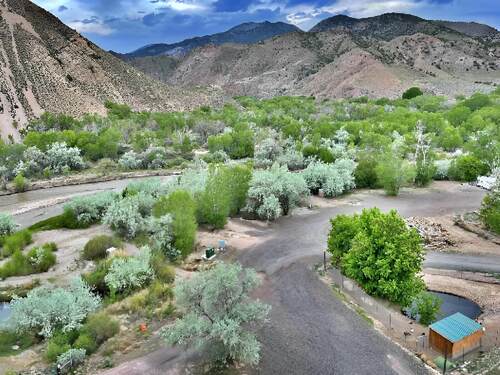
Sevier River RV Park in Sevier, Utah, sits along the Sevier River in central Utah's Fishlake National Forest country — a campground with ATV and biking trails departing directly from the property, alongside cabins, tent sites, and RV hookups for the range of outdoor enthusiasts who use the Sevier County corridor as a base for the extraordinary concentration of ATV trail access, red rock scenery, and public land recreation that this undervisited section of Utah's canyon and mountain landscape provides in the gap between the Dixie and Fishlake National Forests. The campground's trailhead position for direct motorized recreation access and its Sevier River location give guests the immediate outdoor engagement that adventure-oriented camping delivers at its most satisfying. ATV and biking trails starting from the property, combined with the campground's cabin, tent, and RV accommodation range, give the Sevier River RV Park the complete outdoor adventure base infrastructure for the multi-day motorized recreation stays that the Paiute ATV Trail's 900-mile system in southwest-central Utah specifically enables. The Paiute ATV Trail — connecting Richfield, Beaver, Panguitch, and Kanab through the mountains and canyon country of the Fishlake, Dixie, and Manti-La Sal National Forests — is one of the largest and most scenically varied trail systems in the western United States for ATVs, UTVs, and motorcycles, and the Sevier area's position in the system's northern section makes it a natural staging and rest point for multi-day trail expeditions. Pets are welcome. Fremont Indian State Park and Museum, 25 miles north of Sevier in Clear Creek Canyon, preserves the largest known Fremont Indian village site in Utah — a dense concentration of petroglyphs, pictographs, and archaeological features from the Fremont culture that occupied this section of Utah from approximately 700 CE to 1300 CE, creating the most accessible and most interpretively developed Fremont cultural site in the state. The museum's collection of Fremont pottery, figurines, and stone tools contextualizes the petroglyphs that visitors view on the canyon walls above the museum in a way that makes the Clear Creek Canyon site one of the most complete Native American archaeology interpretations in the Colorado Plateau region. Fishlake National Forest, surrounding the Sevier area on multiple compass points, provides 1.4 million acres of central Utah mountain terrain — alpine lakes, aspen groves, and the Fish Lake Plateau at 9,000 to 11,000 feet elevation — that the Fremont River and Sevier River drainages make accessible from the valley floor campgrounds like Sevier River RV Park. Fish Lake itself, the largest natural freshwater lake in Utah at 9,000 feet elevation, sustains one of the finest high-altitude lake trout fisheries in the state and the spectacular aspen color display that the Fishlake Plateau's aspen forest produces in October in the most extensive pure-aspen forest in North America. Sevier River RV Park serves guests year-round in central Utah's four-season continental climate, with the primary ATV season running from May through October and the peak foliage season at Fishlake in October representing a specific and consistently spectacular natural event. The summer months provide the full-range trail access when snow has melted from the higher Fishlake Plateau trails, and the fall season combines the ATV riding with the aspen color that makes the Fishlake-Sevier corridor one of Utah's most rewarding autumn destinations. Reserve sites and cabins ahead for the peak fall foliage weekend in mid-October and during ATV event weekends when the Paiute Trail corridor's visitor traffic fills accommodation in the Richfield-Sevier area.
from $45/night
4.0
Big Rock Candy Mountain Resort
34 RV Sites
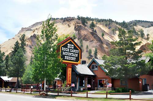
Big Rock Candy Mountain Resort in Sevier, Utah, offers 34 RV sites with full and partial hookups at the base of the actual Big Rock Candy Mountain, with 30 and 50-amp service and rigs accepted up to 80 feet. A zip line through the canyon, bike rentals, on-site dining, and Sevier River access make this a destination rather than a roadside stop on US-89. Thirty-four sites run from water-and-electric back-ins to full-hookup back-in and pull-through configurations carrying 30 and 50-amp, sized to 80 feet, with fire pits. A general store, propane fills, laundry, restrooms, showers, and a dump station handle the practical side. One important caveat: cell service at the resort is essentially non-existent, with coverage available four miles south and seven miles north. There are no phones in the cabins or inn suites, and no payphones — a landline in the convenience store is available during operating hours. The canyon setting drives the recreation. A zip line runs through the colorful canyon terrain, bike rentals open the riverside trail, and the Sevier River supports kayaking, canoeing, and fishing for brown and rainbow trout. Hiking trails climb into the canyon, a recreation center and planned activities fill the calendar, and an on-site dining room covers meals. Off-roading and boating are nearby. Pets are welcome. The mountain itself is the landmark — sulfur-yellow, iron-red, and manganese-white mineral deposits in the canyon walls that gave the classic American folk song its image of an effortless paradise. The resort sits on the US-89 scenic corridor between Richfield and Marysvale. Summer is the peak season for the zip line, river, and trail access; plan communications around the lack of cell coverage before you arrive.
from $42/night
4.67
Fremont River RV
24 RV Sites
On Highway 24 in Loa, Utah—in Wayne County on the Fremont River's upper valley where the Capitol Reef National Park's Waterpocket Fold—a 100-mile-long wrinkle in the earth's crust exposed by erosion into the canyon country's most continuous monocline—lies 15 miles east on the same highway, and where the Fishlake National Forest's 1.4-million acres of high-plateau fish-stocked lakes, aspen groves, and the Fish Lake highland plateau create the southern Utah outdoor recreation corridor that the Wayne County setting concentrates at the geographic center of a five-national-park road trip circuit—Fremont River RV Park provides eight pull-through sites accommodating up to 75 feet, ten back-in sites accommodating up to 60 feet, all with full hookups and 20, 30, and 50-amp service, six tent sites with power and water, a dump station, laundry, restrooms, showers, and fast WiFi in the Loa, Utah highway campground that walking-distance access to groceries, a diner, gas, propane, and auto repair makes the most practically positioned campground between Capitol Reef and the Fish Lake highland. The 75-foot pull-through accommodation, the walking-distance supply access, and the equidistant Capitol Reef and Fish Lake positioning define Fremont River RV's utility as a southern Utah canyon country base camp. Eight pull-through sites accommodating rigs up to 75 feet and ten back-in sites accommodating up to 60 feet—all with full electric, water, and sewer hookups at 20, 30, and 50-amp service—serve the complete RV market from compact travel trailers through the longest Class A diesel pushers at the pull-through positions. Six tent sites with power and water provide the tent-camping option with utility connections. A dump station and water fill handle the black-water management for the arriving guest needing service before a Capitol Reef overnighter. Clean restrooms, showers, and laundry facilities provide the hygiene infrastructure. Fast WiFi, pets allowed, and campfire capability complete the practical daily requirements. Walking distance from the campground: a grocery store, diner, gas, propane, RV supplies, and auto repair—the complete resupply support that the remote Wayne County location needs within walking distance rather than a 50-mile drive. Capitol Reef National Park—15 miles east on Highway 24—preserves the Waterpocket Fold's 100-mile monocline as the park's organizing geological feature, with the Fremont River Canyon cutting through the fold to create the canyon route that Highway 24 follows into the park. The Historic Fruita District within the park—a 19th-century Mormon pioneer orchard settlement preserved within the national park boundary—produces the peaches, apricots, pears, and cherries that park visitors can harvest from the orchards in season as part of the NPS's agricultural heritage program. Fishlake National Forest—accessed via Highway 24 and UT-25 north of Loa—encompasses the Fish Lake highland plateau at 8,800 feet elevation with Fish Lake itself as the centerpiece: a natural high-altitude lake managed for the trophy lake trout and splake fishery that produces the largest freshwater fish in Utah's Fishlake National Forest system. The Fremont Indian State Park and Museum—accessible between Loa and Richfield—presents the largest known Fremont Culture archaeological site in Utah, with petroglyphs, pit house ruins, and the 5,000-artifact museum collection that the 1983 Interstate 70 construction's archaeological salvage produced. Fremont River RV is open year-round. Summer brings the Capitol Reef family season and the Fish Lake fishing peak. Fall's aspen color on the Fish Lake plateau peaks in late September and October, producing the Wayne County drive that photographers and fall color seekers make from across southern Utah. Reserve the pull-through early for summer, walk to the diner, and let the Waterpocket Fold and Fish Lake's high-country plateau earn the southern Utah canyon country base camp experience that the Loa, Utah position at the center of Utah's scenic corridor makes geographically unavoidable.
from $41/night
5.0
Capitol Reef RV Park & Glamping
Between the Boulder and Thousand Lake Mountains in Teasdale, Utah, Capitol Reef RV Park & Glamping occupies one of the most rewarding natural positions available to any campground in the canyon country of the American Southwest. Situated ten minutes from the entrance to Capitol Reef National Park and two miles from the small gateway community of Torrey, the resort serves as the natural basecamp for a national park unit that most American visitors have not yet discovered — which is exactly why those who have keep returning. Spacious RV sites with level gravel pads, 50-amp electric service, water, and sewer connections handle larger rigs with ease, and each site includes a picnic table and fire pit positioned for evening use under the canyon sky. The resort's A-frame glamping cabins are a genuine standout accommodation option — offering an intimate cabin experience in the midst of Utah's high-desert scenery without the setup required for traditional tent camping. A brand-new bathhouse, laundromat, modern clubhouse, and dedicated dog park round out the on-site amenities, all maintained to a consistently high standard. Pets are welcome throughout the property. The landscape surrounding the resort ranks among the most visually striking in the American Southwest. The Waterpocket Fold — a 100-mile-long warp in the earth's crust that defines Capitol Reef's geology — creates a monocline formation that shifts color dramatically through the day from ochre and crimson in morning light to deep purple and rust at dusk. After dark, Teasdale's position within one of Utah's designated dark sky zones produces Milky Way visibility that stops guests in their tracks — one of the more reliable guarantees in travel. The resort's full laundromat handles extended-stay needs without a drive into Torrey, and the modern clubhouse gives guests a comfortable common space for evenings when the canyon temperature drops faster than expected at this elevation. Capitol Reef National Park offers a fundamentally different visitor experience from Utah's other national parks. Hickman Bridge, a 133-foot natural arch reached on a moderate two-mile hike, provides the kind of dramatic payoff usually associated with a full-day backcountry trip. The Fremont Petroglyphs along Highway 24 put thousands of years of indigenous rock art within a short roadside walk. The Capitol Gorge route and the remote Cathedral Valley's towering sandstone monoliths reward those willing to venture beyond the main corridor. ATV trails on Boulder Mountain provide off-road access to terrain above the canyon rims. Capitol Reef RV Park & Glamping is open through the spring, summer, and fall seasons, with the shoulder months of April, May, September, and October delivering the most comfortable temperatures for canyon exploration. Summer canyon floors run hot by midday — early-morning hikes are strongly advisable. A-frame cabins and premium RV sites fill well in advance for any May through September stay; the combination of uncrowded national park access, exceptional stargazing, and glamping quality makes this one of Utah's most sought-after canyon country campgrounds.
from $43/night
3.0
Sun Outdoors Canyonlands Gateway
77 RV Sites, 18 Cabins, 15 Tent Sites, 3 Cottages
At 13701 US Highway 191 in Moab, Utah—in Grand County where the Colorado River cuts through Canyonlands' uplift in the canyon system that has produced the most visually dramatic landscape in the American West, where Arches National Park's 2,000 documented natural sandstone arches rise from the red rock plateau above town, and where the mountain biking, whitewater rafting, four-wheel-drive, and hiking culture of the Colorado Plateau's outdoor recreation economy has made Moab the most visited small city in Utah—Sun Outdoors Canyonlands Gateway provides full hookup RV sites with sites up to 110 feet, an on-site gas station, a general store, a swimming pool with a splash pad, and the comprehensive site infrastructure that Moab's year-round visitor market and its frequent afternoon heat make essential for comfortable multi-day stays at the gateway to two national parks. The on-site gas station alone changes the morning logistics for guests departing for Arches or Canyonlands with a large rig. Deluxe and extra-large RV sites with full hookup service—30 and 50-amp electric, water, and sewer—on leveled gravel pads accommodate rigs from 40 to 110 feet, covering the full spectrum of current motorhome and fifth-wheel lengths. Picnic tables, charcoal grills, cable television, and WiFi are included at each site. Primitive tent sites with picnic tables, charcoal grills, cable, and WiFi, plus water spigots and access to the shared bathhouses, provide the lower-cost camping option. Camping cabins with two full-size beds, heating and air conditioning, linens, and cable and WiFi give guests without RVs the enclosed accommodation option. A swimming pool with an adjacent splash pad provides the afternoon heat relief that Moab's summer temperatures—regularly exceeding 100 degrees from June through August—make genuinely necessary for guests planning to spend mornings in the parks and afternoons at the campground. An on-site gas station, general store, laundry facilities, propane service, multiple picnic areas with fire pits, and covered pavilions with BBQ grills complete the resort's full-service infrastructure. Arches National Park, accessible from the resort within minutes on US 191 north, provides the sandstone arch concentration that has made Moab internationally recognizable—Delicate Arch's 65-foot span above the Colorado River canyon appearing in virtually every piece of Utah promotional material since Edward Abbey's Desert Solitaire popularized the Arches landscape in 1968. The park's 2,000-plus documented natural arches, fins, and balanced rocks are accessible on the park road with developed trailheads ranging from the 100-yard Windows Section walk to the strenuous Devil's Garden Primitive Loop. Canyonlands National Park, the larger and less-visited counterpart to Arches, divides its terrain into three distinct districts separated by the Colorado and Green Rivers' confluence—the Island in the Sky mesa above the river junction providing the most accessible and panoramic viewpoints in the Colorado Plateau system. Dead Horse Point State Park, perched above the Colorado River's 2,000-foot Goose Neck canyon in a position that most Moab visitors cite as more visually stunning than anything in either national park, is accessible on the same road as the Island in the Sky and should be included in any Canyonlands day trip. Sun Outdoors Canyonlands Gateway operates year-round in Moab's four-season desert climate. Spring and fall offer the most comfortable temperatures for hiking and cycling; summer brings the heat but also the full river rafting season on the Colorado's Cataract Canyon. Reserve your extra-large site early for spring break and the fall October shoulder season, fill up at the on-site gas station on the morning of your national park drive, and let Grand County's canyon geology earn what two national parks within 30 minutes of each other look like when the red rock is catching the first light.
from $21/night
5.0
Phillips RV Park
42 RV Sites, 3 Tent Sites
Phillips RV Park in Evanston, Wyoming, has operated under family ownership since 1936, bringing nearly nine decades of accumulated hospitality experience to a campground that has served travelers on the US-189/US-30 corridor in Uinta County since the era when the Lincoln Highway carried the first transcontinental automobile tourists through the high-desert sagebrush country of southwestern Wyoming. The park's longevity reflects the consistent quality and personal attention that multi-generational family operation typically produces, and its position in Evanston—Wyoming's gateway city from Utah on I-80—makes it a natural stopping point for travelers moving between the Wasatch Front and the Wyoming high country. The park provides full hookup sites with water, electric, and sewer connections on big-rig-friendly pads, with clean restrooms, showers, laundry, a playground, and Wi-Fi rounding out the amenity set that extended-stay and transit guests alike require. The Bear River's proximity, noted in the park's listing of nearby features, adds a natural waterway element to the setting—a creek-side character that the high desert communities of southwestern Wyoming provide rarely, given the predominantly arid and treeless landscape that defines the region between the Wasatch and the Medicine Bow ranges. Pet-friendly policies welcome the dogs that many western travelers bring on road trips through Wyoming's wide-open spaces. Evanston's position in the Bridger Valley at 6,748 feet elevation in the Bear River drainage puts guests in a landscape defined by the high sagebrush steppe characteristic of the Great Basin's eastern margins—vast, windswept, and dramatically open in a way that the tree-covered mountain ranges of the surrounding Uinta and Bear River ranges make more visually complex than the simple flat-desert stereotype. The Bear River Migratory Bird Refuge, managed by the U.S. Fish and Wildlife Service in the Bear River Valley to the southwest near Brigham City, Utah, is one of the premier wetland bird sanctuaries in the Interior West, with shorebird and waterfowl diversity during migration season that attracts serious birders annually. The Uinta Mountains rise dramatically to the south of Evanston along the Utah border—the only major mountain range in the contiguous United States with an east-west orientation rather than north-south—and the Ashley National Forest's Wyoming portion provides hiking and fishing access in the Uinta's northern drainages. Flaming Gorge National Recreation Area, approximately 60 miles south in Utah, protects the Red Canyon and Green River reservoir system with boating, fishing, and geological touring that showcases the spectacular canyon geology of the Colorado Plateau's northernmost extent. Salt Lake City lies approximately 90 miles southwest via I-80 for guests who want access to Utah's urban amenity set. Phillips RV Park operates year-round in Evanston's high-altitude Wyoming climate, where summers are pleasantly cool compared to lower-elevation camping alternatives and winter brings the cold and occasional snow that characterize every Wyoming mountain community. The park's 1936 founding gives it a historical depth unusual among operating campgrounds, and the family's decades of experience managing a gateway-community campground has produced the kind of operational reliability and local knowledge that independent travelers on long western road trips particularly value. The park's combination of solid infrastructure, family ownership character, and strategic I-80 gateway positioning makes it a consistent and trustworthy choice for Evanston overnight stays.
from $26/night