Spot2NiteSpot2Nite

Pet Friendly

One of over 34 Spot2Nite camping activities

Experience the joy of camping with your furry companions at pet-friendly campgrounds and RV parks. These destinations offer amenities like off-leash dog parks and pet washing stations to ensure your four-legged family members are as comfortable and entertained as you are in the great outdoors.

RV parks and campgrounds with Pet Friendly near Escalante, Utah.
Instant book

Up to 10% off

image 0

Canyons of Escalante RV Park

28 RV Sites

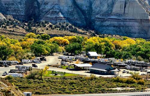
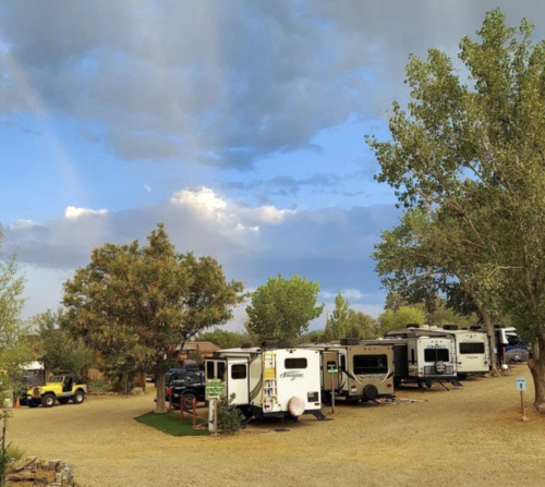
Canyons of Escalante RV Park in Escalante, Utah, occupies a privileged position at the edge of one of the most remote and geologically spectacular landscapes in the American West, serving as the primary gateway community for travelers entering Grand Staircase-Escalante National Monument from the north. Family-owned and genuinely embedded in the small-town character of Escalante—population under 800—the park offers a warm, personalized alternative to chain campgrounds for visitors pursuing serious backcountry exploration across Utah's canyon country interior. The park provides full hookup sites with water, electric, and sewer service alongside clean restroom and shower facilities built to the standard that multi-day backcountry travelers need after long days on remote trails. An on-site dining option covers the practical concern of meals without requiring a longer drive, and the park's staff functions as an informal visitor center, with deep local knowledge about current road conditions, trailhead access, permit requirements, and the flash flood forecasts that every canyon country visitor needs to monitor carefully. Escalante sits at 5,800 feet elevation on a high Colorado Plateau mesa rimmed by the grand geological staircase—a series of stepped cliffs dropping south through pink, white, and grey limestone and sandstone layers from Bryce Canyon's rim to the Arizona Strip below. The surrounding terrain is a labyrinth of slickrock domes, narrow slot canyons, arched alcoves, and cottonwood-lined drainages that hide Ancestral Puebloan ruins, natural bridges, and swimming holes visited by only a fraction of Utah's park tourists. Wildflowers carpet the canyon rims in spring, and fall light transforms the sandstone into rich amber and rust tones that make October one of the most visually rewarding months in the entire Southwest. Bryce Canyon National Park lies approximately 45 miles to the west, and Capitol Reef National Park anchors the landscape roughly 70 miles to the northeast, making Escalante a logical midpoint on any multi-park Utah itinerary. The monument itself conceals premier destinations including the famous slot canyons of Peek-a-Boo and Spooky Gulch, the vast Paria Canyon-Vermilion Cliffs Wilderness to the south, and Calf Creek Falls—a 126-foot cascade plunging into a turquoise swimming hole reached via a 6-mile round-trip trail from a BLM trailhead east of town that remains one of Utah's most rewarding family hikes. Canyons of Escalante RV Park operates seasonally from spring through fall, with peak visitation concentrated in May, September, and October when canyon temperatures are comfortable and the combination of wildflowers, fall color, and lower tourist volumes creates ideal backcountry conditions. Summer brings intense afternoon heat in the canyon depths and significantly elevated flash flood risk in the slot canyons, making shoulder-season timing important for guests planning technical routes. Advance reservations for spring and fall are strongly recommended, as Escalante's limited lodging inventory and the monument's draw fill available accommodations quickly during optimal visitation windows. The park's small size relative to the monument's enormous scale means staff can offer genuinely individualized guidance, a meaningful advantage for first-time canyon country visitors navigating unfamiliar terrain and permit systems that can be confusing without local orientation.

from $53/night

Bryce Valley Ranch RV & Horse Park

69 RV Sites

Bryce Valley Ranch RV and Horse Park in Cannonville, Utah, offers 69 full-hookup RV sites just below the rim of Bryce Canyon National Park, with 30 and 50-amp service and rigs accepted to 75 feet on a big-rig-friendly layout. Categories publish their exact length — 35, 65, and 75 feet — with separate adult-only and family pull-through sections, plus horse pens for equestrian guests. Sixty-nine sites span back-in 30-amp at 35 feet, back-in 30/50-amp at 75 feet, and pull-thru 30/50-amp at 65 feet in both adult-only and family sections, all carrying water, sewer, and electric with site WiFi, with fire pits, picnic tables, and BBQ pits. Publishing length by category removes all guesswork, and separating the adult-only and family sections is a thoughtful touch that serves both. A general store, laundry, propane fills, restrooms, showers, firewood, horse pens, and a pet washing station handle the practical side. One safety note the park states plainly: a river runs at the back of the property and can flash flood from heavy rain at higher elevations. Walking trails, a community fire pit, playground, dog park, and pavilion fill the grounds, with hiking, biking, fishing, canoeing, kayaking, and offroading nearby. The horse pens are the differentiator — this park serves riders who want to bring their own animals onto the Grand Staircase backcountry trails, which very few properties accommodate. The family operating it has two decades in this corner of canyon country. Spring and fall are peak at Bryce. Reserve well ahead.

from $36 $31/night

Bryce Canyon RV Resort

45 RV Sites, 14 Cabins, 19 Tent Sites

In the canyon country of Garfield County, Utah, just off Scenic Byway 12 in the small community of Cannonville, Bryce Canyon RV Resort by Rjourney provides full hookup RV sites, tent camping, and pet-friendly cabin accommodations for travelers seeking a genuine base camp for exploring one of the most concentrated collections of canyon country landmarks anywhere in the American Southwest. Bryce Canyon National Park is the primary destination draw, but the full itinerary available from Cannonville extends well beyond the park's boundaries into terrain that ranks among the most photogenic and least crowded in all of Utah. On-site amenities balance convenience with the outdoor focus that guests in this part of Utah prioritize. Full hookup RV sites, water and electric tent sites, and pet-friendly cabins with four designated dog-friendly options give different types of travelers appropriate accommodation choices. A heated swimming pool and camp store provide warm-weather relief and day-to-day convenience, and free WiFi, laundry facilities with coin-operated machines, propane service, and a dump station with freshwater rinse round out the practical infrastructure. A dog park with pet waste stations throughout the grounds reflects genuine pet hospitality rather than token accommodation. The combination of services is well-calibrated for travelers who spend the day in the canyon country and want hassle-free comfort upon return. Bryce Canyon National Park is the destination magnet that brings most guests to Cannonville, and the park's hoodoos, spires, and amphitheaters deliver on every expectation formed by photographs. Sunrise and sunset from Bryce Point, Rainbow Point, and Inspiration Point produce colors and shadow play that remain impossible to fully capture in images regardless of camera quality. The park's network of accessible rim trails and below-the-rim hikes gives guests of all fitness levels meaningful canyon country engagement, and the dark skies over Bryce—designated an International Dark Sky Park—produce nighttime viewing that consistently ranks among the best in the national park system. The terrain surrounding Bryce Canyon extends the experience considerably for guests who take the time to explore. Kodachrome Basin State Park, a few miles south of Cannonville, takes its name from the vivid reds and oranges of its stone spires and sedimentary columns—colors so striking that National Geographic used them for the magazine's first color photography. Grosvenor Arch, Willis Creek Slot Canyon, Red Canyon on US-12, and the Cottonwood Canyon Road across the Grand Staircase-Escalante National Monument provide additional canyon country exploration that comparatively few Bryce visitors make time to experience. Scenic Byway 12 itself is one of America's designated All-American Roads. Bryce Canyon RV Resort operates seasonally with peak season running from spring through fall to match the national park's primary visitation period. Summer weekends and the shoulder-season photography months of late September and October book quickly, and reservations well in advance are necessary for July and August. The resort's location in Cannonville provides a quieter alternative to the more crowded accommodations directly adjacent to the park entrance. Book your site, plan your sunrise alarm, and discover why the Colorado Plateau's canyon country never fails to astonish.

from $37/night

Capitol Reef RV Park & Glamping

Between the Boulder and Thousand Lake Mountains in Teasdale, Utah, Capitol Reef RV Park & Glamping occupies one of the most rewarding natural positions available to any campground in the canyon country of the American Southwest. Situated ten minutes from the entrance to Capitol Reef National Park and two miles from the small gateway community of Torrey, the resort serves as the natural basecamp for a national park unit that most American visitors have not yet discovered — which is exactly why those who have keep returning. Spacious RV sites with level gravel pads, 50-amp electric service, water, and sewer connections handle larger rigs with ease, and each site includes a picnic table and fire pit positioned for evening use under the canyon sky. The resort's A-frame glamping cabins are a genuine standout accommodation option — offering an intimate cabin experience in the midst of Utah's high-desert scenery without the setup required for traditional tent camping. A brand-new bathhouse, laundromat, modern clubhouse, and dedicated dog park round out the on-site amenities, all maintained to a consistently high standard. Pets are welcome throughout the property. The landscape surrounding the resort ranks among the most visually striking in the American Southwest. The Waterpocket Fold — a 100-mile-long warp in the earth's crust that defines Capitol Reef's geology — creates a monocline formation that shifts color dramatically through the day from ochre and crimson in morning light to deep purple and rust at dusk. After dark, Teasdale's position within one of Utah's designated dark sky zones produces Milky Way visibility that stops guests in their tracks — one of the more reliable guarantees in travel. The resort's full laundromat handles extended-stay needs without a drive into Torrey, and the modern clubhouse gives guests a comfortable common space for evenings when the canyon temperature drops faster than expected at this elevation. Capitol Reef National Park offers a fundamentally different visitor experience from Utah's other national parks. Hickman Bridge, a 133-foot natural arch reached on a moderate two-mile hike, provides the kind of dramatic payoff usually associated with a full-day backcountry trip. The Fremont Petroglyphs along Highway 24 put thousands of years of indigenous rock art within a short roadside walk. The Capitol Gorge route and the remote Cathedral Valley's towering sandstone monoliths reward those willing to venture beyond the main corridor. ATV trails on Boulder Mountain provide off-road access to terrain above the canyon rims. Capitol Reef RV Park & Glamping is open through the spring, summer, and fall seasons, with the shoulder months of April, May, September, and October delivering the most comfortable temperatures for canyon exploration. Summer canyon floors run hot by midday — early-morning hikes are strongly advisable. A-frame cabins and premium RV sites fill well in advance for any May through September stay; the combination of uncrowded national park access, exceptional stargazing, and glamping quality makes this one of Utah's most sought-after canyon country campgrounds.

from $43/night

Thousand Lakes RV Park

43 RV Sites

Eleven miles west of Capitol Reef National Park's visitor center on Utah State Route 24 in the small community of Torrey, Thousand Lakes RV Park has been orienting guests toward the Waterpocket Fold's extraordinary geology for decades—a family-operated campground with full hookup RV sites, water and electric positions, tent sites, and deluxe cabin rentals where a camp store, swimming pool, on-site restaurant, and the red rock views from every campsite serve the national park visitor who wants a comfortable and established operation rather than the self-serve minimalism of the park's own campgrounds. Wayne County's canyon landscape, visible from the pool deck and the campground's open eastern orientation, makes Thousand Lakes one of the most visually rewarding campground experiences in the Colorado Plateau national park corridor. Full hookup sites with water, electric, and sewer service, water-and-electric-only sites, and dry camping positions accommodate the full range of RV configurations and tent camping preferences, with each site positioned to maximize the red rock views that the State Route 24 address provides. Deluxe cabins with their own bathrooms, air conditioning, TV, microwave, refrigerator, and linens—plus super deluxe options with full kitchens, separate bedrooms, and sleeping lofts—serve guests who want a roofed accommodation in the outdoor setting of a campground. An on-site restaurant serving made-to-order meals that can be delivered to campsites, a swimming pool, clean shower houses, laundry, basketball court, a dog walking area, and a stocked camp store complete the campground service infrastructure. Capitol Reef National Park's central feature—the Waterpocket Fold, a nearly 100-mile-long wrinkle in the Earth's crust where the Colorado Plateau's sedimentary rock layers were pushed upward and tilted to reveal 270 million years of geological time in a continuous exposure—creates the canyon, ridge, and natural tank landscape that makes Capitol Reef one of the most geologically spectacular and least-visited of the Southwest's major national parks. The park's Fruita Historic District, a 19th-century Mormon pioneer settlement in a Fremont River oasis of orchard trees, allows visitors to pick fruit from the original pioneer orchards free of charge during harvest seasons—a living agricultural history experience unique among American national parks. The surrounding Wayne County landscape provides some of Utah's most spectacular and least-crowded scenic experiences outside the park boundaries—the Cathedral Valley scenic loop north of the park traverses the remote northern section of the Waterpocket Fold through a landscape of volcanic monoliths and sandstone temples that rivals the park's primary corridor in visual drama but receives a fraction of the visitor traffic. Goblin Valley State Park, about 45 miles northeast through the San Rafael Swell, provides the most surreal geological landscape in Utah in its mushroom-shaped sandstone hoodoos—a playground of balanced rocks and erosion forms that children and adults alike navigate with equal wonder on warm afternoons. Torrey's high-desert elevation of 6,900 feet makes summer camping at Thousand Lakes noticeably cooler than the canyon-floor temperatures within the park itself, with evenings regularly dropping to the 50s even in July when midday temperatures in the Waterpocket Fold exceed 90 degrees. The fall season from September through October provides the most balanced conditions—comfortable temperatures for both photography and hiking, the amber light that makes the red rock geology most saturated in color at sunrise and sunset, and the reduced visitor traffic that allows the park's backcountry roads and canyon trails to be experienced in genuine solitude. Spring wildflowers in the Fremont River's riparian corridor and the Capitol Reef orchards' fruit-picking seasons each summer provide seasonal reasons to time a visit around specific natural phenomena.

from $43/night

Instant book

image 0

Fremont River RV

24 RV Sites

On Highway 24 in Loa, Utah—in Wayne County on the Fremont River's upper valley where the Capitol Reef National Park's Waterpocket Fold—a 100-mile-long wrinkle in the earth's crust exposed by erosion into the canyon country's most continuous monocline—lies 15 miles east on the same highway, and where the Fishlake National Forest's 1.4-million acres of high-plateau fish-stocked lakes, aspen groves, and the Fish Lake highland plateau create the southern Utah outdoor recreation corridor that the Wayne County setting concentrates at the geographic center of a five-national-park road trip circuit—Fremont River RV Park provides eight pull-through sites accommodating up to 75 feet, ten back-in sites accommodating up to 60 feet, all with full hookups and 20, 30, and 50-amp service, six tent sites with power and water, a dump station, laundry, restrooms, showers, and fast WiFi in the Loa, Utah highway campground that walking-distance access to groceries, a diner, gas, propane, and auto repair makes the most practically positioned campground between Capitol Reef and the Fish Lake highland. The 75-foot pull-through accommodation, the walking-distance supply access, and the equidistant Capitol Reef and Fish Lake positioning define Fremont River RV's utility as a southern Utah canyon country base camp. Eight pull-through sites accommodating rigs up to 75 feet and ten back-in sites accommodating up to 60 feet—all with full electric, water, and sewer hookups at 20, 30, and 50-amp service—serve the complete RV market from compact travel trailers through the longest Class A diesel pushers at the pull-through positions. Six tent sites with power and water provide the tent-camping option with utility connections. A dump station and water fill handle the black-water management for the arriving guest needing service before a Capitol Reef overnighter. Clean restrooms, showers, and laundry facilities provide the hygiene infrastructure. Fast WiFi, pets allowed, and campfire capability complete the practical daily requirements. Walking distance from the campground: a grocery store, diner, gas, propane, RV supplies, and auto repair—the complete resupply support that the remote Wayne County location needs within walking distance rather than a 50-mile drive. Capitol Reef National Park—15 miles east on Highway 24—preserves the Waterpocket Fold's 100-mile monocline as the park's organizing geological feature, with the Fremont River Canyon cutting through the fold to create the canyon route that Highway 24 follows into the park. The Historic Fruita District within the park—a 19th-century Mormon pioneer orchard settlement preserved within the national park boundary—produces the peaches, apricots, pears, and cherries that park visitors can harvest from the orchards in season as part of the NPS's agricultural heritage program. Fishlake National Forest—accessed via Highway 24 and UT-25 north of Loa—encompasses the Fish Lake highland plateau at 8,800 feet elevation with Fish Lake itself as the centerpiece: a natural high-altitude lake managed for the trophy lake trout and splake fishery that produces the largest freshwater fish in Utah's Fishlake National Forest system. The Fremont Indian State Park and Museum—accessible between Loa and Richfield—presents the largest known Fremont Culture archaeological site in Utah, with petroglyphs, pit house ruins, and the 5,000-artifact museum collection that the 1983 Interstate 70 construction's archaeological salvage produced. Fremont River RV is open year-round. Summer brings the Capitol Reef family season and the Fish Lake fishing peak. Fall's aspen color on the Fish Lake plateau peaks in late September and October, producing the Wayne County drive that photographers and fall color seekers make from across southern Utah. Reserve the pull-through early for summer, walk to the diner, and let the Waterpocket Fold and Fish Lake's high-country plateau earn the southern Utah canyon country base camp experience that the Loa, Utah position at the center of Utah's scenic corridor makes geographically unavoidable.

from $41/night

Instant book

image 0

Dixie Forest RV Resort

29 RV Sites, 14 Cabins, 13 Tent Sites

At 555 South Main Street in Panguitch, Utah—in Garfield County on Highway 89 in the red rock canyon landscape of southern Utah's Colorado Plateau where the Paunsaugunt Plateau's pink limestone cliffs tower above the Sevier River Valley and Bryce Canyon National Park's hoodoo formations are 26 miles to the east in a landscape that concentrates three major national parks and two national monuments within a 90-mile driving radius—Dixie Forest RV Resort by Rjourney provides full hookup pull-through sites accommodating rigs to 65 feet, tent sites, and cabins sleeping up to six within walking distance of downtown Panguitch's restaurants and shops in the southern Utah gateway configuration that Panguitch's position as the region's most central service town makes particularly functional. The three-national-park proximity and the downtown walkability are the two facts that define Dixie Forest's market position. Full hookup pull-through sites with 30 and 50-amp electric, water, and sewer connections accommodate the largest big rigs in the fleet at up to 65 feet, with picnic tables and fire rings at each site. Tent sites serve the lightweight camper. Cabins accommodating up to six guests provide the enclosed lodging alternative for guests without RVs or preferring solid walls in the high desert's summer thunderstorm season. A swimming pool provides the summer heat relief that southern Utah's July and August temperatures make particularly welcome. A playground, horseshoes, and volleyball court extend the on-site recreation options. A dog park serves the traveling pet population. Free WiFi provides the connectivity that guests using the campground as an extended base camp for multi-day park touring specifically require. The campground's South Main Street location—within walking distance of Panguitch's downtown commercial district—eliminates the supply-run logistics that remote campgrounds in the canyon country impose. Bryce Canyon National Park's silent amphitheaters, carved into the Paunsaugunt Plateau's edge by frost and rain over millions of years, produce the hoodoo formations—thousands of orange, red, and white limestone spires—that make Bryce Canyon the most visually alien and emotionally affecting landscape in the Colorado Plateau. The Rim Trail along the plateau's edge, the Navajo Loop's descent into the canyon, and the Queens Garden Trail's traverse among the hoodoos constitute a day-hiking menu that Bryce concentrates into fewer trail miles and more accessible terrain than any comparably spectacular canyon park in the region. Zion National Park—approximately 90 miles southwest via Highway 89—and Capitol Reef National Park—90 miles northeast—constitute the two additional park anchors in the southern Utah concentration that no other state in the American West matches. Cedar Breaks National Monument, 32 miles south via Highway 143, provides a Bryce Canyon-adjacent amphitheater experience at higher elevation with fewer crowds. Panguitch Lake, 17 miles south of the campground, provides the trout fishing and boating alternative that the reservoir's 1,250-acre surface in the Dixie National Forest makes accessible as a half-day from the campground. Dixie Forest RV Resort is open seasonally through the southern Utah desert camping calendar, with the peak national park visitor season from May through October coinciding with the campground's operational schedule. Bryce Canyon's predictable afternoon summer thunderstorms, the cool early-morning light that creates the most photogenic hoodoo conditions, and the Milky Way astronomy that the Garfield County dark sky designation makes possible on clear nights define the daily rhythm. Reserve early for summer weekends, download the Bryce Canyon trail map, and let Highway 89's gateway position deliver the three-park concentration that Utah's canyon country makes accessible from a single Panguitch base camp.

from $25/night

Instant book

image 0

Bryce Canyon Shadows Campground

26 RV Sites, 7 Tent Sites, 4 Motel Rooms

Bryce Canyon Shadows Campground in Panguitch, Utah, is a campground minutes from Bryce Canyon National Park — a well-positioned Garfield County property on US-89 that gives guests the practical overnight base for one of the most visually distinctive national parks in the American West, the hoodoo and amphitheater terrain of the Paunsaugunt Plateau's eroded Claron limestone in the most photographically celebrated orange and red rock formation landscape in the Colorado Plateau's southern Utah national park corridor. Panguitch's Garfield County position on US-89, 24 miles north of the Bryce Canyon entrance on UT-12, gives the campground the specific gateway character of the park's primary overnight accommodation corridor for the visitors who prefer the small-town Panguitch accommodation over the National Park Lodge's in-park lodging at the significantly higher price point. A range of RV hookup sites and tent camping with the complete practical campground infrastructure give Bryce Canyon Shadows the comfortable overnight base for the park day-trip schedule that the early-morning and late-afternoon light on the hoodoo amphitheaters specifically rewards — the Bryce Amphitheater's sunrise colors on the hoodoo columns and the evening's alpenglow on the limestone pinnacles give the morning and evening park visits the photographic quality that justifies an overnight stay in the Panguitch-Bryce corridor over the single-day stop from the Las Vegas or Salt Lake City gateway drives. Pets are welcome. Bryce Canyon National Park, 24 miles south of Panguitch on UT-12 and UT-63 in Garfield County, preserves the most concentrated hoodoo landscape in the world — an amphitheater series carved into the Pink Cliffs of the Paunsaugunt Plateau by frost-wedging in the porous Claron limestone that creates, on average, 200 freeze-thaw cycles per year and produces the hoodoo column formations at a geologically rapid pace in the park's five major amphitheaters from Bryce Amphitheater south to Rainbow Point. Sunrise Point, Sunset Point, and Inspiration Point give the rim viewshed the most visited hoodoo panoramas, and the Navajo Loop Trail's Wall Street slot canyon descent into the amphitheater floor gives hikers the hoodoo-level perspective from within the formation landscape. Red Canyon, 11 miles east of Panguitch on UT-12 in the Dixie National Forest, is a smaller but equally photogenic hoodoo corridor that US-89 and UT-12 pass directly through — the red Claron limestone arches and hoodoo columns that frame the highway give Red Canyon the drive-through geological spectacle quality of a Bryce Canyon approach experience that the free federal forest land provides without the national park entrance fee. The Red Canyon's bike path through the arch tunnels and the moderate hiking trails in the surrounding formation landscape give it the accessible southern Utah geology day walk for families who want the hoodoo experience with the crowd density below Bryce Canyon's peak visitor season. Bryce Canyon Shadows Campground serves guests through the Panguitch area camping season from spring through fall, with the peak Bryce Canyon visitation from May through September sustaining the primary demand and the spring astronomy season from March through April and the fall foliage season from late September through October giving the Panguitch area its two most distinctive non-summer visitor experiences. Panguitch's historic downtown, with the late-19th-century brick commercial block and the Garfield County heritage, gives the campground's guests the small-town Utah main street character that the gateway-to-Bryce position sustains as both a practical supply stop and a genuinely preserved rural Utah community. Reserve sites well ahead for the Memorial Day weekend through Labor Day peak Bryce Canyon season.

from $46/night

Instant book

Elite Retreat

image 0

Lake Powell Gateway RV Resort

32 RV Sites

At the edge of Glen Canyon National Recreation Area in Big Water, Utah—the last community on US-89 before the Arizona border and the gateway to the most spectacular canyon country in the American Southwest—Lake Powell Gateway RV Resort positions guests within striking distance of Horseshoe Bend, Antelope Canyon, the Wahweap Marina, and the red rock landscape that has made the Lake Powell region one of the most visually dramatic recreation destinations in the United States. The resort's 32 full hookup sites with shade canopies, concrete pads, and an arcade stocked with 3,000-plus classic games provide the creature comforts that make extended canyon country exploration sustainable in the region's intense heat. The location does the heavy lifting; the resort keeps guests comfortable between canyon adventures. All 32 sites come fully equipped with 20, 30, and 50-amp electric service alongside water and sewer connections, and each site features a shade canopy, picnic table on a concrete pad, and a BBQ pit and smoker—a combination well-suited to the high-desert environment where the difference between shade and full sun is measured in dozens of degrees. A swimming pool and hot tub provide essential cool-weather and warm-weather aquatic relief, and the resort's arcade—featuring more than 3,000 classic games—gives families with children a full-day indoor entertainment alternative when afternoon heat makes canyon exploration impractical. A convenience store handles provisioning needs, horseshoe pits provide casual outdoor recreation, and WiFi, restrooms, and showers complete the full-service infrastructure that the resort's pricing reflects. The Vermilion Cliffs landscape surrounding Big Water offers the most concentrated geological drama in North America. The Colorado Plateau's layered sandstone, carved by wind and water over 270 million years into the formations that define the American Southwest's visual identity, reaches its most spectacular expression in this corner of Utah and Arizona. The late afternoon light on the red rock escarpment visible from the resort provides the kind of color show that makes landscape photographers specifically plan trips around the golden hour in this region—a daily spectacle that requires no driving or planning beyond simply being present. Horseshoe Bend—the iconic 1,000-foot meander of the Colorado River visible from the rim above Page—is within practical driving range and represents one of the most-photographed landscapes in the American West for verifiable reasons: the scale, the color, and the complete improbability of the river's path through the canyon are genuinely astonishing in person. Antelope Canyon, the sinuous slot canyon whose light beams draw photographers from across the world, is equally accessible. Wahweap Marina on Lake Powell provides boat rental access to the reservoir and the canyon system it has flooded. The Wave, Buckskin Gulch, and the off-road terrain of the surrounding BLM land extend the adventure programming for guests with multiple days available. Lake Powell Gateway RV Resort operates year-round, though spring and fall represent the optimal seasons for canyon country exploration—summer temperatures regularly exceed 100 degrees, making shade canopies and the swimming pool survival infrastructure rather than amenities. Site rates run $65 to $95 per night depending on position and season. Reserve your shaded concrete pad, plan your Horseshoe Bend sunrise, and let the Utah-Arizona border region earn its reputation as the most scenically concentrated corner of the American Southwest.

from $50/night

Instant book

image 0

Panguitch Lake Resort

47 RV Sites

At 8,000 feet in the mountains of southern Utah, Panguitch Lake sits in a world apart from the red-rock canyons that define most visitors' image of the state. Surrounded by ponderosa pines and aspen groves with the Markagunt Plateau rising on all sides, the 1,250-acre lake stays cool and fishable through the summer months when the canyon country below bakes under full desert sun. Panguitch Lake Resort occupies a prime position on the lakeshore, giving guests immediate access to some of the best trout fishing in Utah while placing them within day-trip range of three national park units. The resort offers a range of accommodations from full-hookup RV sites to rental cabins along the lakeshore, with boat rentals available on-site for guests who want to get out on the water without trailering equipment from home. The high-elevation setting keeps summer temperatures in the comfortable 70s during the day, dropping to the 40s and 50s at night — a welcome contrast for travelers escaping heat at lower elevations. The relaxed, unhurried pace of life at the lake makes Panguitch Lake Resort a destination where many guests find they stay considerably longer than planned. Rainbow and brown trout draw anglers from across the region, and Panguitch Lake consistently produces fish throughout the open-water season. The lake's depth and cold temperature maintain excellent water quality and oxygen levels that keep the trout active even in midsummer, unlike many lower-elevation fisheries. Fly fishing from shore is productive along the inlet and outlet areas, while trolling and still-fishing from a boat cover the main basin effectively. The resort's boat rentals make planning a fishing-focused trip straightforward without requiring a boat trailer. Cedar Breaks National Monument, just 17 miles east at the rim of the Markagunt Plateau, delivers views into a half-mile-deep amphitheater of crimson and orange hoodoos that rival anything in Bryce Canyon with a fraction of the crowds. Bryce Canyon National Park itself is about 49 miles south along US-89, making a half-day or full-day loop entirely reasonable from Panguitch Lake. Red Canyon, along the way to Bryce, offers excellent cycling on a paved bike path through coral-colored rock formations. Zion National Park, roughly 90 minutes south, is achievable as a day trip for guests willing to make an early start. Panguitch Lake Resort operates through the summer and early fall, with the fishing season at its peak from late spring through September. The lake typically remains ice-free from May into early November, though exact dates vary by year and snowpack. Fall brings stunning aspen color to the surrounding hillsides, typically peaking in late September, and the shoulder-season crowd is considerably lighter than the summer rush. Winter closes the resort but opens excellent snowmobile terrain on the plateau. For summer holiday weekends and the prime fishing season of June through August, reservations well in advance are strongly recommended.

from $60/night

Instant book

image 0

Pine Creek Cabins Resort

A mile west of the community of Marysvale in the Sevier River valley of south-central Utah, Pine Creek Cabins Resort sits at the entrance to Bullion Canyon on a Pine Creek property that places guests at the center of the Paiute All-Terrain Vehicle Trail System—one of the largest OHV trail networks in the United States, with more than 2,000 miles of interconnected trails through the canyon and mountain terrain of a five-county southern Utah corridor. Six log cabin rentals, a glamping tent, and three full-hookup RV sites with stunning views of the Tushar and Monroe Mountains serve the small-scale resort community in a setting where mature trees, a babbling creek, and the canyon mouth's dramatic geology create the kind of base camp that ATV riders, hikers, and fly anglers organize extended Utah mountain stays around. Six furnished log cabins alongside Pine Creek each include two queen beds, a full bathroom, TV, dining table, mini fridge, microwave, kitchen essentials, a propane BBQ, and a picnic table—the complete self-sufficient accommodation for groups of 2-4 without requiring restaurant access for every meal. A glamping tent with a king-size bed, full-size futon, private bathroom, and mini split AC and heat extends the roofed accommodation options for guests who want outdoor proximity without a sleeping bag. Three full-hookup RV sites with canyon and mountain views provide the connection for self-contained travelers, and the secure, ample parking area for trucks and trailers serves the ATV hauling rigs that constitute a large portion of the resort's guest population during the peak riding season. Pine Creek, running past the resort's cabin foundations in the sound of a high desert mountain stream, provides trout fishing in the cold, clear water draining Bullion Canyon's high-elevation terrain above the resort—a fishing resource that complements the broader sportfishing available in the Sevier River downstream and the fishing lakes within the Fishlake National Forest to the north. The Paiute ATV Trail's immediate access from the resort property means that riders can leave the parking area and begin trail riding without the trailhead drive that many OHV destinations require, a convenience that maximizes time in the saddle during the peak summer and fall riding seasons when the canyon terrain is at its most accessible and beautiful. Big Rock Candy Mountain, visible from the highway at the northern end of Marysvale Canyon, is one of Utah's most distinctive geological landmarks—a multicolored mountain of iron, sulfur, and manganese mineral deposits in shades of yellow, orange, and white that inspired the 1895 folk song and remains one of the most photographed roadside geological features in the American West. The Tushar Mountains, rising to 12,174-foot Delano Peak southwest of Marysvale, provide some of the most accessible high-elevation terrain in southern Utah—accessible from Bullion Canyon Road—with wildflower meadows, aspen groves, and alpine lakes in a mountain environment that the surrounding desert's summer heat makes feel remarkably remote. Bryce Canyon National Park lies about 75 miles south. The Marysvale area's high-elevation desert climate delivers warm, dry summers with cool nights ideal for resort camping when the surrounding valley heat moderates in the canyon terrain. The Paiute ATV Trail's primary riding season runs from late spring through mid-fall, with peak activity from June through October when the canyon and mountain terrain is at its most accessible and the wildflower and aspen color seasons bookend the summer with their own sequential beauty. Winter closes most high-elevation trail segments but the Marysvale Valley's snowmobile tradition activates during heavy snow years, and the resort's winter shoulder season offers quiet cabin stays in the canyon's snow-covered landscape for guests who seek the Tushar Mountains in their cold-season character.

from $41/night

Instant book

image 0

Bryce Zion Campground

36 RV Sites, 3 Cabins, 20 Tent Sites

Bryce Zion Campground in Glendale, Utah, is a campground between two of America's most extraordinary national parks — positioned along U.S. Highway 89 in Kane County's red rock canyon country in the geographic corridor between Bryce Canyon National Park to the north and Zion National Park to the southwest, offering log cabin accommodations and RV and tent sites in a desert landscape of juniper and sage where the Colorado Plateau's multilayered Mesozoic geology and the southern Utah desert's extraordinary scenic quality surround the campground on all sides with the red, orange, and white sandstone that the national park pair specifically protects. Glendale's Kane County position on U.S. 89 between the two parks gives guests the dual-park access that maximizes the value of a single southern Utah basecamp. Log cabins, RV sites, and tent camping give Bryce Zion Campground the accommodation range for the varied visitor profiles that the Bryce-to-Zion corridor attracts — from the full-size RV traveler routing through southern Utah's national park circuit to the tent camper seeking the rustic log cabin alternative to their own sleeping equipment in a desert setting where nighttime temperatures drop reliably even in summer. The campground's between-the-parks position minimizes the driving that separates the two national park experiences. Pets are welcome. Bryce Canyon National Park, 45 miles north of Glendale on U.S. 89 and Utah 12, protects the world's largest concentration of hoodoos — the spire-shaped pillars of pink Claron limestone that frost heaving and erosion sculpt from the Paunsaugunt Plateau's rim in the most visually theatrical geological landscape in the American Southwest. The Navajo Loop Trail descends 550 feet through Wall Street's narrow slot between the hoodoo fins and the Two Bridges formation in the 1.3-mile loop that gives first-time visitors the most concentrated and most dramatic Bryce Canyon hoodoo experience in the trail system. The park's elevation at 8,000 to 9,000 feet gives it nighttime temperatures cool enough for sleeping bag camping even in July, and the Milky Way visibility from the dark-sky designated plateau makes Bryce Canyon's night sky one of the most rewarding stargazing destinations in the western United States. Zion National Park, 45 miles southwest of Glendale via U.S. 89 and State Route 9, protects the Zion Canyon — a 15-mile-long sandstone canyon carved by the Virgin River through 2,000-foot Navajo Sandstone cliffs in the most-visited national park in Utah at over 5 million annual visitors. Angels Landing's 1,488-foot vertical cliff-edge trail with the chain-assisted final section and The Narrows' 16-mile slot canyon wade through the Virgin River's 30-foot-wide channel give Zion the most dramatic human-scale adventure hiking experiences in the national park system, and the Emerald Pools trails and Weeping Rock's hanging garden give the casual visitor the accessible canyon beauty that the park's strenuous hikes complement. Bryce Zion Campground serves guests through the southern Utah visiting season, with the spring from April through June and the fall from September through October representing the most comfortable temperature windows for both national parks — the summer months bring 90-degree valley floor temperatures at Zion while Bryce's elevation keeps it 20 degrees cooler, and the winter months offer the specific photography experience of hoodoos dusted with snow that Bryce Canyon's winter visitation specifically serves. Coral Pink Sand Dunes State Park, 20 miles south of Glendale, provides the OHV and sand dune climbing experience that extends the Glendale day-trip range. Reserve cabins and sites months ahead for the spring and fall shoulder seasons.

from $45/night


Spot2Nite is the easiest way to find and book RV parks and campgrounds.

Look

Look

Search for camping spots by location and date. Apply filters for RV, tent, lodging, or glamping accommodations to narrow your search with dozens of amenity, activity, and park features.

Book

Book

Once you’ve found a camping accommodation that matches your criteria, learn about the park and review the amenities—then book the park in just a few clicks.

Go

Go

After booking your campsite directly through Spot2Nite, you will receive an email confirmation to start you on your adventure.